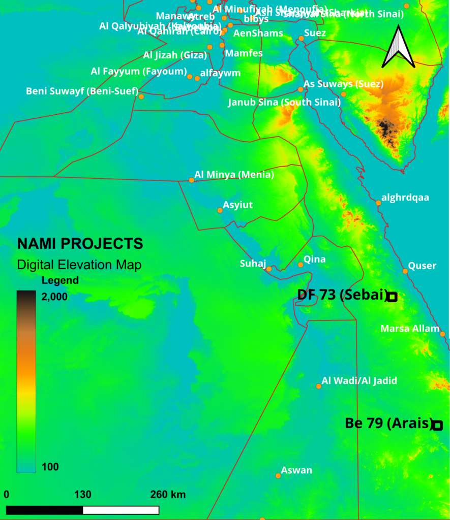
Egypt Eastern Desert (EED)
North Africa (NAMI) had awarded in The EED 2 blocks comprise 351km2 of greenfield exploration through Arabian Nubian Shield.
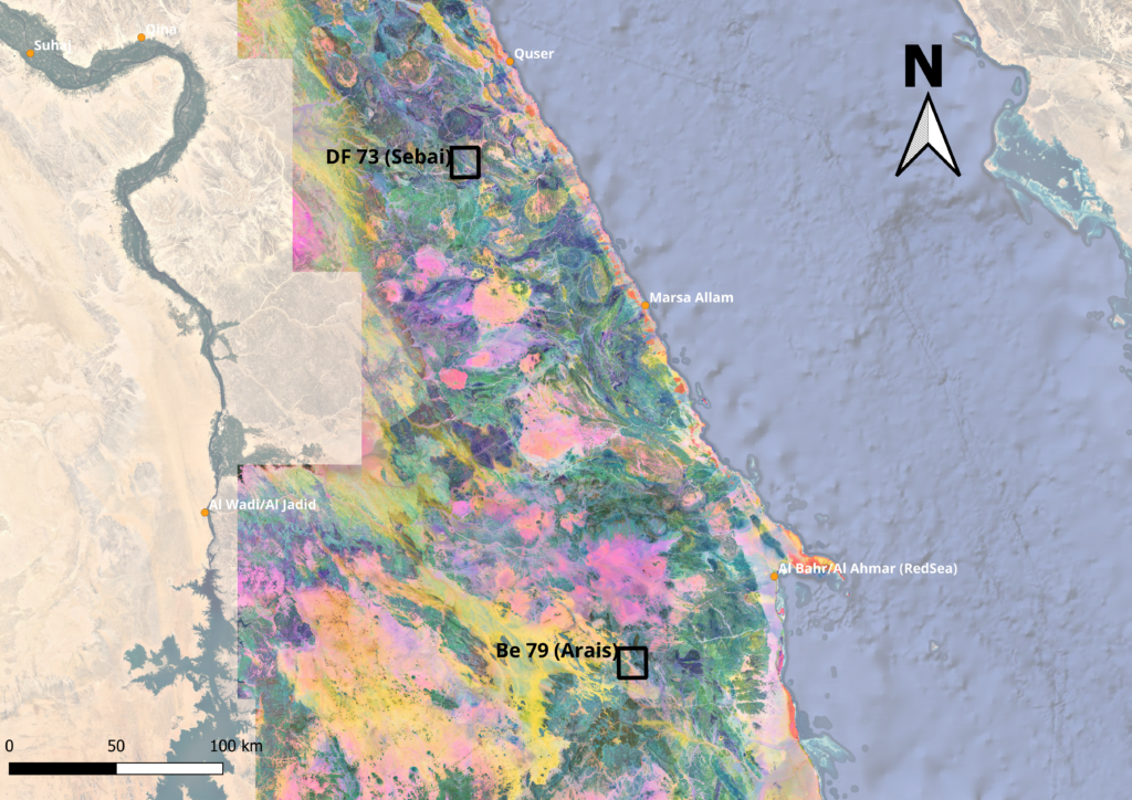
This area hadn’t been explored with the Modern techniques ,So Our Technical team had employed optical remote sensing data to extract geological information, depending on the geological setting of area of interest, the use of optical multispectral images is playing an important role in recent years by providing a wealth of information in this field, such as geological structure and lithological mapping, the optical images can simplify the interpretation and improve the accuracy of recognizing and detecting lithological units.. The land package is divided into 2 Blocks:
- Sebai Block DF 73 (174 km2) – The concession area lies in the Central Eastern Desert, southwest of Qusier City to form a part of the Neoporeterozoic evolution of the Nubian Shield .
- Arais Block Be 79 (177 km2) – Concession site is located northwest of the city of Shalaten, 40 km on asphalt road of Shalaten – Marsa Alam, and then 80 km on the asphalt road to the village of Abraq and then 20 km along desert track to the area .
- Remotely sensed data offers powerful tool in identifying the variations in surface mineralogy, structural elements, and geologic contacts, visual interpretation and quantitative image processing including band ratio and principal component analysis (PCA) coupled with fieldwork could be very successful in lithological mapping of the gold mineralization, remotely sensed images cannot replace this level of expertise; however, they can form valuable supplements that are more cost-effective than traditional methods, remote sensing data can give information for a larger area in inaccessible regions and help to isolate potential areas from non-interesting areas for further exploration.
- To map bedrock and identify presence and abundance of specific minerals at specific scale, it is possible to use remote sensing techniques, suitable image processing techniques are used to extract useful geological information . From
Sentinel 2 PCA Mosaic Texture drived from AW3D30 Digital Surface Model (DSM) :
- DataSer : Sentinel 2 Level L2Av
- Analysis : PCA For (B2,B3,B4,B8,B8A,B11&B12)
- Band Composition : PC1/PC2/PC3 in RGB
- Resolution : 30 meter/Pixel
- CS : WGS1984
Digital Elevation Model of NASADEM comes in 1 arc degree blocks :
- Spatial Resolution: 1 arcsecond / Pixel
- CS: WGS1984